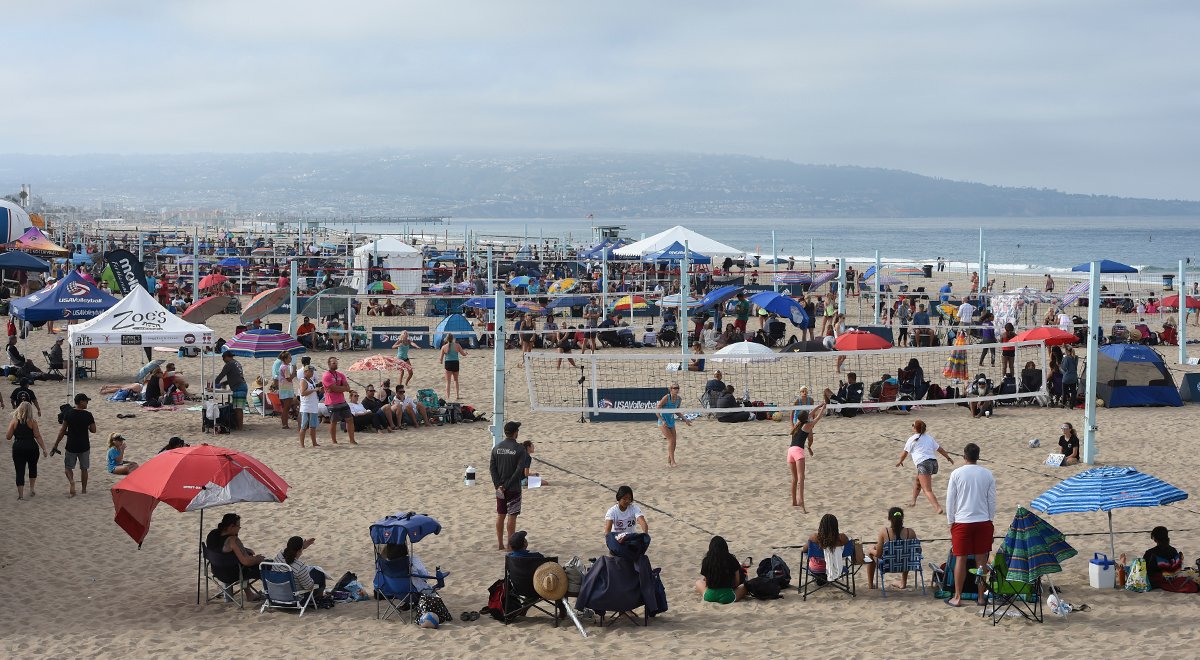
Southern California: the birthplace and perennial hotbed of beach volleyball. What is it about this area that makes it so ideal for beach volleyball? One factor is its weather. When athletes can practice year-round on deep-sand beaches, it creates hours of opportunity to hone one’s skills.
Ryan Kittell, a forecaster with the National Weather Service in Oxnard, which oversees the coastal areas of Los Angeles, helps explain why Southern California’s weather patterns are perfect for beach volleyball.
Consistency is Key
Unlike most of the United States, the weather in Southern California is consistent. This is due in part to long-term weather patterns that occur from interactions between the Pacific Ocean to the west and desert mountains to the east.
It is important to note that these “patterns are consistent, so they can be anticipated, but the weather is always variable,” Kittell states.
During the warmer months, an area of high pressure develops over the Pacific Ocean called the Eastern Pacific High (EPAC High). High pressure is associated with good weather. According to Kittell, “Its presence is so consistent that it’s there about nine months out of the year.” In the fall and winter months, the weather pattern shifts. The cold air over the Great Basin (portions of Nevada, Oregon, and Utah) builds up an area of high pressure over the land, while low pressure develops in the North Pacific Ocean. So how do these patterns affect the day-to-day weather for the beach?
Weathering It Out on the Court
As with most of the United States, temperatures in Southern California cool down when the fall and winter weather patterns settle in, but not by much. Overnight low temperatures along the coast can drop below 50° F (10° C) while high temperatures can reach above 65° F (18° C), depending on conditions. Additionally, winter is the rainy season, peaking around January-February. The low-pressure system sitting over the Northern Pacific, called the Aleutian Low, is an origin point for storm systems that march through the U.S., and it can amplify storms that are near the low. Depending on the storm tracks and the placement of the Aleutian Low, it can draw up moisture from the Southern Pacific, leading to more cloud cover and rain chances in the area.
Takeaways for the Cooler Months (October – March)
- Bring warmer clothing: be sure to have sweats or a jacket at the ready for those cooler temps
- Check the weather: winter is the rainy season in Southern California
- Be Prepared with sand socks: overnight low temperatures on the beach can drop the sand temperature to 50° F (10° C) or lower. The sand will stay cold through the morning until the sun has had a few hours to warm it up
- Sunscreen: while it may not be summer, the sun is still a factor. Be sure to use sunscreen on exposed skin to protect from UV rays
Once the summer weather pattern kicks in, not much will change until the fall. This makes it is easy to know what the weather will be when heading out to the beach. The marine layer and Catalina Eddy help keep the coastal areas cooler than the rest of the desert southwest. The marine layer is the name for the cool, moisture-rich airmass that sits over the ocean.
When the warmer desert air interacts with the Pacific Ocean, it cools down and begins to condense into cloud droplets. This cloud cover can linger on the beaches through the morning hours.
“That’s why we have terms like ‘May gray’ and ’June gloom,’” Kittell jokes. Once the sun breaks through, temperatures quickly get up to around 80° F (26° C) on the coast. Temperatures stay cooler on the coast compared to areas further inland because the sea breeze brings cooler air ashore. The sea breeze (detailed previously) is slightly stronger on the west coast due to the greater temperature differences as the Pacific Ocean is cooler than the Gulf of Mexico and Atlantic Ocean.
The Catalina Eddy is a south/southeasterly wind feature local to Southern California. It helps build the marine layer and push it onshore. The eddy is caused in part by the coastline changes in Southern California. Unlike most of the Pacific coastline, Southern California’s coast does not have a strong north-south orientation. “[There is a] sharp turn towards the east on the coastline south of Point Conception,” says Kittel. “Those northerly winds from the EPAC High trying to flow parallel to the coast can’t make that sharp turn.
The result is that winds begin to swirl from the main north-south flow, creating a wind that blows onshore from the south/southeast along the beaches.”
Eddy winds are fairly light in the morning hours before the sea breeze kicks up in the afternoon.
Takeaways for the Warmer Months (May – September)
- Wear Layers: between cloud cover and cooler temperatures, it is important to have something to keep warm during the morning hours. The beach warms up very quickly once the sun comes out, so be ready to shed some layers as the day progresses
- Afternoon Winds: the sea breeze picks up in the early afternoon bringing winds onshore ranging from 10-15 mph
- Don’t forget sunscreen! Cloud cover does not block UV rays, so it is possible to still get sunburned when the sun is blocked by the marine layer
- Protect Your Feet: The sand gets incredibly hot during the peak of summer. Be sure to have sand socks or sandals to keep your feet from getting burnt
Whenever you find yourself out in Southern California, use these tips to prepare for the weather conditions. We look forward to seeing you out on the beach!
Coral Arroyo-Baez is a Coordinator, Beach Events at USA Volleyball. She studied meteorology at Florida State and tracks the weather for USAV beach events. Follow her on Twitter and listen to her episode of The USA Volleyball Show.
